Know Your Data: Harvest Area

This is part of our series to help seafood professionals, newcomers and enthusiasts navigate the complexities of sourcing data. For more, read about species and vessel identifiers.
If watching a fishing vessel slowly disappear into the mist doesn't make you wonder "which management area are they headed to?" congratulations—you're a normal person. However, the captain certainly knows and if you work in the seafood supply chain it is increasingly important to show your buyers and regulators that you do too. A big part of demonstrating legal and sustainable sourcing comes down to the harvest area, which is why we're diving into this particularly messy data element today. Here is a rundown of the most commonly used fisheries management areas and our thoughts on what to track:
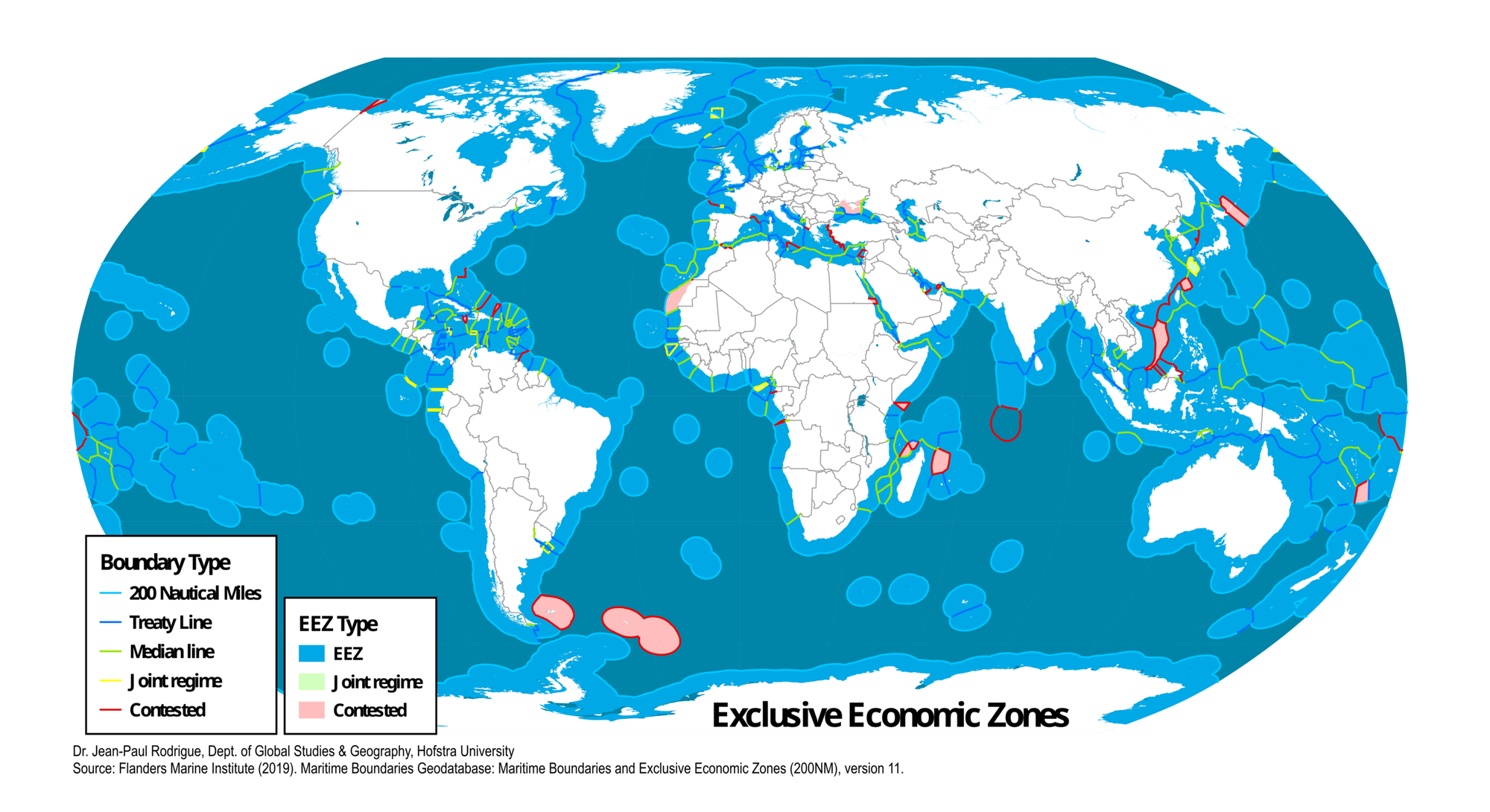
Exclusive Economic Zone (EEZ)
Coastal nations have exclusive rights to extract and manage natural resources up to 200 nautical miles from their shoreline. Countries can permit foreign operators to fish in their EEZ, but it is not a free-for-all. EEZs play a key role in fisheries management worldwide but there are gaps: the darker blue portions of the map below that fall outside an EEZ denote international waters, also known as the High Seas.
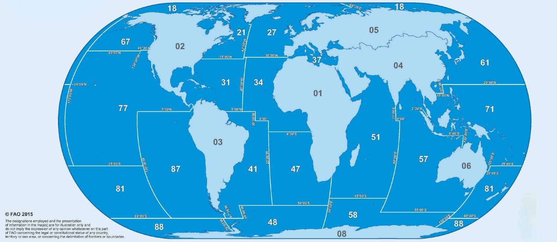
FAO Fishing Area
The Food and Agriculture Organization of the United Nations has divided land and sea into a number of Major Fishing Areas identified by numerical codes as depicted below. These areas are used quite often in harvest reporting, though they are not usually managed as distinct areas themselves.
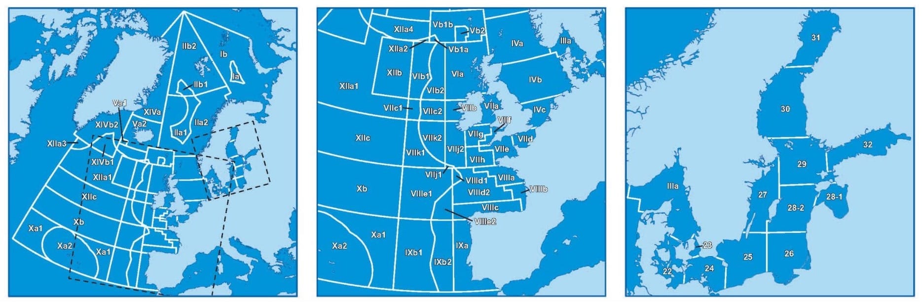
Each FAO Major Fishing Area area is further divided into sub-areas, as these can get quite complicated. For example, if you work with fish caught in the European Union you may have come across ocean areas managed by the International Council for the Exploration of the Sea (ICES), depicted below.
Regional Fisheries Management Organization (RFMO)
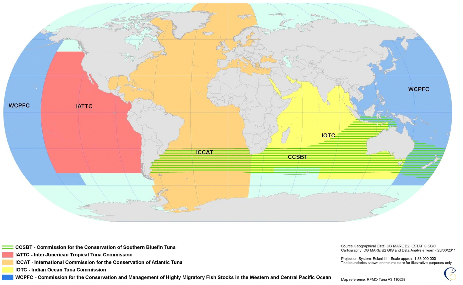
Countries with shared fishing interests in a particular region form coordinated management bodies usually referred to as RFMOs. RFMOs are responsible for ensuring the long-term conservation and sustainable use of fish stocks in their designated areas through cooperative management measures and regulations.
Other management areas
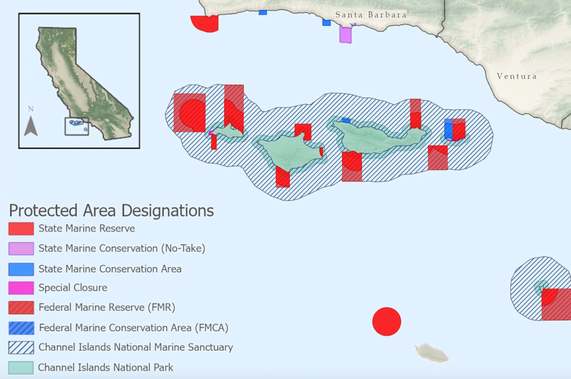
Many countries have detailed fishery management zones within their EEZ, such as the very narrow example pictured below of California's protected areas around the Channel Islands. These zones allowing for more localized management and monitoring based on fish stocks, conservation and other ocean uses.
Our Advice
- Always check for inconsistencies
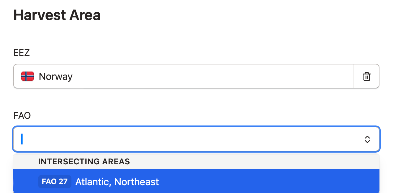
Be sure that the harvest areas provided by your supplier line up; these inconsistencies are easy for trained regulators to pick out as errors or indicators of fraud. Goldfish solves this issue with smart drop-down menus so, for example, picking Norway as the EEZ means the only overlapping FAO Major Fishing Area is #27.
- Know what you need to track.
When it comes to tracking data, here are our general recommendations, though you should check to ensure compliance with applicable regulations, standards or certifications your company follows.
For Export/Import
- Exclusive Economic Zone or RFMO. Indicates the fishing regulatory body.
- FAO Major Fishing Area. Widely used for trade documentation.
For Domestic Reporting
- FAO Sub-Area or other management area. Often required for fishermen to report their catch to local managers.
Probably TMI (too much information)
- Vessel tracking (GPS/AIS) location. You might see this requested for some voluntary standards, but we have yet to see this level of detail required as a part of regular supply chain documentation for a number of reasons. For more on this, read Do I need to know exactly where a vessel was fishing?
- CATAIR Ocean Area. Required solely for US seafood imports, your broker or entry filer will be able to figure this out based on other harvest area information provided on their own, or using Goldfish's smart dropdown for this data element.